 Albertans in Space
The evening sky · November 2026 · free
Alberta Skychart
What’s overhead this month. A free two-page sky map, drawn for Alberta’s latitude from real star and planet positions. Print it, fold it into a coat pocket and go outside.
On the sheet
- Format
- 11 × 8.5 in
- Pages
- 2
- Drawn for
- 52° N, central Alberta
- Price
- Free
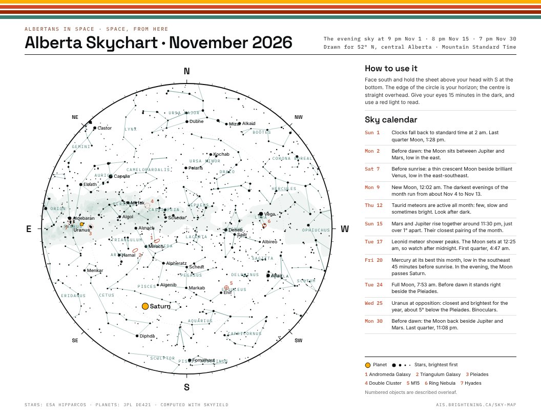
Page one: the chart
The whole sky as it looks overhead, with the horizon on the rim and north at the top so it reads correctly when you hold it above your head. Planets, the brightest stars and the constellations are labelled. A sky calendar runs down the side with the month’s moon phases, meteor showers and close pairings.
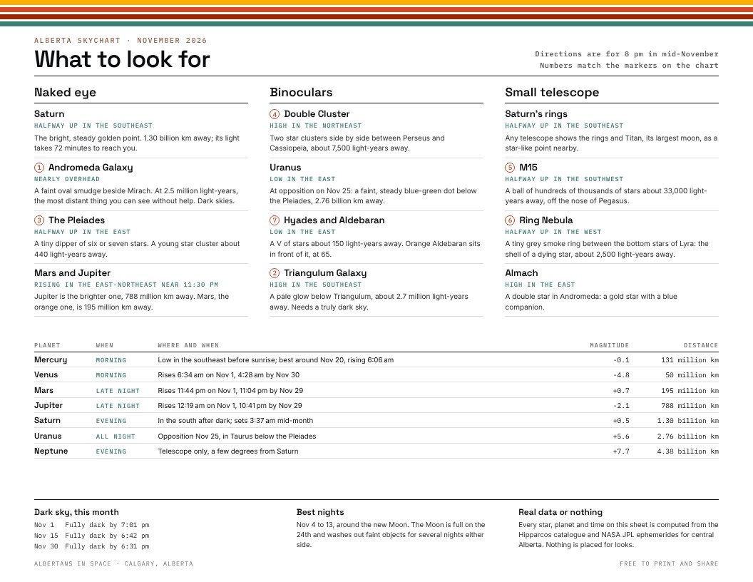
Page two: what to look for
The best sights of the month, grouped by what you need to see them: your eyes, binoculars or a small telescope. Each one says where to look, what it is and how far away. A table gives every planet’s rising time, brightness and distance.
Real data or nothing
Star positions come from the Hipparcos catalogue and planets from NASA JPL’s ephemerides, computed for central Alberta. Nothing is drawn by hand or placed for looks. If a star is on the map, it’s really there.